Home
Purpose
Course Descriptions
School Yachts
Schedule of Courses
Ocean Training Cruises
ASA Certification
Registration Info
Our Location
Our People
Contact Us
|
| Course: |
Advanced Coastal Cruising; Rock Hall to Mystic |
| Date: |
July 9-16, 2002 |
| Vessel: |
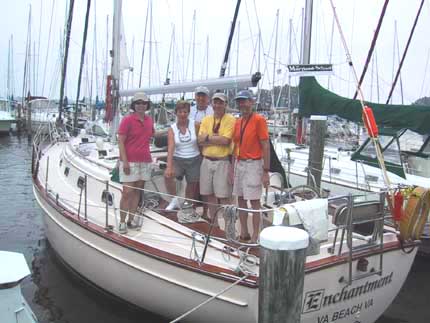
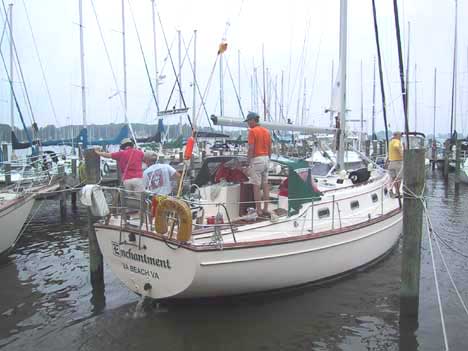
IP40 ENCHANTMENT
|
| Students: |
Tom & Mary Ann Bedwell and Alan & Arlene Thornton |
| Captain: |
Eric Petterson |
7/9/02
The student crew, Tom & Mary Ann Bedwell and Alan & Arlene Thornton
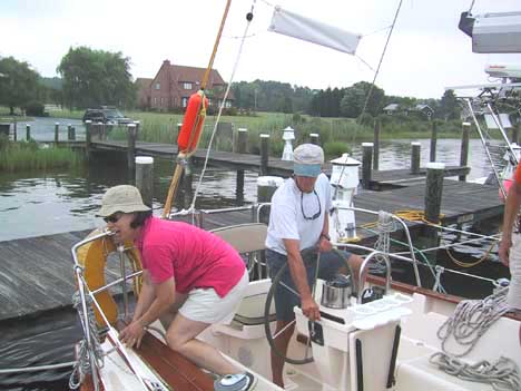
arrived at 0900. The morning was spent stowing personal gear, reviewing ships
inventory and overall stowage, and getting the crew familiar with the boat and
gear. After lunch we all went to the grocery to buy
provisions; then it was back to the boat to store everything away. Next was a
walk-through of all ships systems and the rig. Lastly we discussed operating
procedures, assignments and watch schedules. As navigation is a key aspect of this
course, we agreed to have a rotational navigator
assignment, and do the navigation without the benefit of GPS for our coastal
passages.
7/10/02
We left Spring Cove Marina at 0925, motoring out into a light 5-8 knot breeze
from the north. Underway we did MOB maneuvers under power with Williamson and
Race Track turns. Mary Ann was the navigator of the day and she was kept busy
taking LOPs to track our progress. Many buoy numbers do not match the charts due
to a recent CG renumbering. But the internet data pulled prior to our departure
helped to sort things out. We arrived at the C&D canal at Engineers Cove at
1630, right at low tide. We "felt" our way into the anchorage slowly
and set the anchor for the night at 1645.
7/11/02
The navigator for today had several problems to deal with, including strong
Delaware Bay currents, low tide upon leaving Engineer's Cove and the 55 foot
bridges on the Cape May canal. Alan was the navigator and with his direction we
left the anchorage prior to low tide at 0420,
sighting bald eagles in the early morning sunlight. We entered the bay at 0630
and set sail in 10-12 knots from the NNE. With this wind we had a delightful
sail down the bay, arriving at the entrance to the Cape May canal at 1400, just
prior to low tide. This gave us adequate clearance
under the bridges, which we passed on our way to Utsch's Marina, and were in our
slip 1450.
7/12-13/02
We left Cape May at 1410 for the trip up the New Jersey coast in order to time
our arrival into Atlantic Highlands. The navigator for this leg was Arlene and
she also established the course about five miles offshore staying seaward of the
offshore buoys. After leaving the inlet we set sail and sailed along the coast
in 10-15 from the SE. This wind held until 0230 when we it died and we began
motoring. Everyone was surprised to see how well they could steer a compass
course and find the buoys without the GPS. As we approached northern New Jersey
the shipping traffic picked up considerably and everyone got a chance at
monitoring traffic using compass bearings. We rounded Sandy Hook and arrived at
Atlantic Highlands at 1100 and picked up a mooring for the night.
7/14/02
With Tom as the navigator we left Atlantic Highlands at 0910. Winds were very
light, and we tried to sail but within an hour gave up and motored. Made our way
under the Verazzano Narrows Bridge into New York harbor with all of the other
normal New York traffic... ferries, commercial shipping, recreational boaters,
etc. Went by the Statue of Liberty, Ellis Island, lower Manhattan with a gaping
void where the Twin Towers once stood, and up the East River under the Brooklyn
Bridge. Our target was to arrive at Hell Gate at slack water, which our
navigator hit with almost perfect precision. Finally we arrived at City Island
and tied upin the marina at 1550.
7/15/02
The navigator for this first leg in Long Island Sound was Mary Ann and her job
was to choose an acceptable anchorage for the forecast weather and the next
day's run to Mystic. She chose Duck Island Roads, and we were off at 0500 to
optimize currents. With no wind we were again forced
to resort to motoring, so we did knot tying exercises while underway. We reached
our destination at 1435, dropping anchor off the shore for protection from the
forecast W to NW winds behind a passing cold front. Thunderstorms were
predicted, but we didn't have any.
7/16/02
Up anchor for the final leg of the passage at 0725 with Alan and Arlene as joint
navigators. The winds had performed as predicted and we had a nice 12-15 knot
wind from the north withgreat sailing all the way to Noank. Along the way we
passed close to a New London ferry and called
on VHF to establish passing instructions. After a stop for fuel and pump-out we
arrived at Noank Village Boatyard at 1345. Final distance logged for the trip
was 339 nautical miles.
Captain Eric Petterson
S/V ENCHANTMENT, IP40
Noank, CT
July 16, 2002

to Ocean Reports
Return to Home

|