Home
Purpose
Course Descriptions
School Yachts
Schedule of Courses
Ocean Training Cruises
ASA Certification
Registration Info
Our Location
Our People
Contact Us
|
| Course: |
ASA106 Virgin Islands Coastal Cruise |
| Date: |
Feb 23-Mar 2, 2013 |
| Vessel: |
CELESTIAL IP440
|
| Students: |
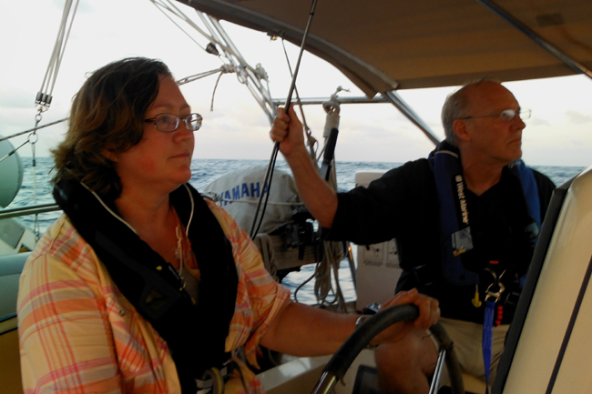
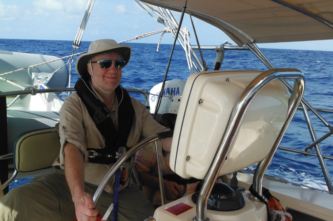
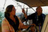
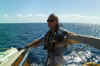
Robert Bell, Edward McDonald, George
Norwood, Andrew Scott, Susan Sharkey |
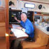
| Captain |
H.
Jochen Hoffmann |
Day
1: Departure Preparation
Yesterday, Ed, a naval architect, volunteered to help with boat maintenance, and
his assistance was most welcomed and appreciated. The afternoon and evening were
marked by crew arrivals, introductions and dinner ashore. My shipmates are an
accomplished group of sailors, boat owners, or large-ship voyagers. Today, we
begin with meal planning and provisioning.
While Susan and the captain go shopping, Andy, Ed, George (“ Nordie”),
and Robert work down lists as part of departure preparation. They are guided by
Nordie, an experienced offshore sailor. Training on lines, sails, emergency
equipment and systems below familiarize all with the complexities of an ocean
yacht. In the afternoon, we rig the boom crutch, deploy both anchors for
practice, and make ready for sea.
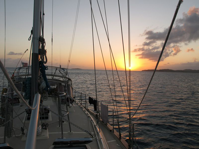
By 1630,
after one more check of the weather report, we cast off, practice engine
maneuvers, and discuss navigational hazards, including nearby cruise ship
traffic. All the while, we follow Susan’s navigation plan past two airport
perimeter buoys toward a waypoint at 18º20’ N and 065º00’ W. But where are
the two buoys? Our copy of the
latest issue of the USCG Local Notice to
Mariners provides the answer: they are reported missing. Leaving the setting
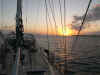
sun behind us, Susan navigates us carefully into Lindbergh Bay for the ASA106
night anchoring exercise just after nightfall. Since it gets dark early in the
tropics, dinner is not too late, and we still have energy left to take bearings
as part of a proper anchor watch.
Day
2: Lindbergh Bay to Christmas Cove, Great St. James Island
The nearly always predictable Trade Wind weather is holding with winds ESE at
12-15 knots and chance of tropical showers. For today, Andy has prepared a fine,
leg-by-leg nav plan he will be using to pilot us safely up E Gregerie channel,
through St. Thomas Harbor via Overhaul Cut and on to Christmas Cove via Buck
Island and Packet Rock as way points. Tides and current tables, part of
everyone’s navigation preparation, indicate that tidal ranges remain under one
foot and that current set is from E to W with drift averaging one knot. We begin
with all-hands training in protected waters including anchoring, MOB, engine
maneuvers and bearing fixes and this ensures that crew skills are tuned to the
challenging conditions entailed in this advanced coastal cruising course.
|
|
Next, we
motor up E Gregerie Channel. Here comes Andy’s first navigational challenge:
no chart shows, but reading the U.S. Coast Pilot closely reveals that Overhaul
Cut is also used as the landing strip for the St. Thomas Sea Plane Base. Now,
our lookout is truly busy. Fortunately, at this hour no plane is buzzing us.
Andy’s second surprise comes as he pilots us to the exact way point of Packet
Rock Red nun buoy “2”. Again, where is the buoy? Anxious lookouts finally
turn ones more to the USCG-Local Notice to
Mariners. Voila, R “2” has been reported missing as well!!! A sigh of
relief follows. Once we reach crowded Christmas Cove and are anchored, we opt
for a quick swim and early dinner to be rested for our upcoming offshore leg.
Day
3: Great St. James Island to a Waypoint in the Caribbean Sea SE of St. Coix,
USVI
Sunrise is at 0645, but we are up and breakfasted well before that. Ed’s
navigation plan for this leg calls for a course of 140 deg. True (T) to Saba
Bank, lying WNW off Saba Island, Netherlands Antilles. His two way points of 60
and 80 NM distant, respectively, assume either moderate or fresh easterly Trade
Winds. We have fresh winds alright, but they have shifted to the SW requiring us
to steer close hauled at 155 T. That course will take us straight to Long Bank,
an elliptical, submerged coral shelve extending some 10 miles ENE from the E end
of St. Croix. Because of building winds, we had earlier put two reefs in the
main sail to reduce heel. It worked. Now, we have to decide whether to tack east
toward our planned course and avoid potentially breaking waves at the shallower
reef extension or fall off and cross at the 60’ to 65’ depth contours closer
to St. Croix.
|
|
Since
crew members are still finding their sea legs in winds now up to 18 knots,
gusting to 22 knots, at 1500 we cross at the 65’ depth and fall off to a 75
deg. wind angle to flatten the boat to achieve a more comfortable ride. With
plenty of daylight left, we practice MOB evolutions under sail, including
deployment of the offshore Pole-Horseshoe-Strobe system better to mark a
potential victim’s position. This exercise is going so well that I am
confident we can do it at night, which is one of several ASA106 standards. True
enough, this is accomplished in total darkness before crew turns in for a few
hours of sleep.
Earlier
in the day, I had set watches for a 4-on-8-off schedule where the “off”
designation is a misnomer since countless boat duties have to be performed as
well. The night watchstanders are:
·
2000 to 0000: Captain and Andy
·
0000 to 0400: Nordie and Robert
·
0400 to 0800: Susan and Ed
As we
speed along at 6 to 7 knots, we keep a sharp lookout for distant traffic that is
not moving. Our AIS identifies it as a Tanker, Not under Command. An unusual
sight anywhere at sea
|

|
Day
4: Caribbean Sea S of St. Croix to Esperanza, Vieques, SVI
About 1000 last night - St. Croix some 40 NM to our north and long out of sight
- Andy and the captain tacked to haul the wind on our starboard quarter on a
course worked out by Robert of 330 per ship’s compass (psc) to Esperanza on
Vieques. At midnight, Nordie and Robert relieve the previous watch. By 0300,
wind now steady above 22 knots, I go on deck to assist Nordie and Robert to reef
the jib down to a scrap. Still, we are making 5 to 6 knots, but the boat is
handling much better now. Before daybreak, the on-watch, Susan and Ed, are able
to "dip" the light on St. Croix as planned. This means they are
starting to see the light on the horizon on its 7 NM range circle W of the
island as indicated on the chart. As Ed knows from his recent Coastal Navigation
course, a compass bearing on the light at such a moment will yield a fix.
With the
wind now gusting to 25 knots, Susan at the wheel, we arrive at Esperanza at 0925
– 30 minutes ahead of the ETA that Robert had
calculated last night. While we tease him that his calculation was off, all
agree: “Not bad, navigator.” To our relief we are able to clear into Customs
by phone since Andy, who had hurt his shoulder on day one but carried on
valiantly, finds he needs medical attention. We are sorry to have to bid
farewell to a wonderful shipmate and help him catch the ferry to Puerto Rico.
After
rest and boat clean up, our nice dinner in Esperanza is preceded by one more
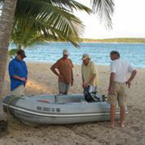
adventure – a boarding stern wave catches us as we try to beach the dinghy.
Day
5: Spanish Virgin Islands: Esperanza to Ensenada Honda on Culebra
Today’s leg requires all of our navigational skills. There are reefs along the
Vieques coast, reef patches all along our winding approach into Culebra and buoy
patterns which, at first glance, don’t seem to make sense. To boot, bearing
fixes are nigh impossible, given high, wind-whipped seas. This is one time where
our pre-planning really counts. Nordie has skillfully worked out a precise
course sequence using charted features, but especially a succession of range
lights, which keep us right in the channel center where reefs on either side are
only a biscuit toss away. What joy to be able drop anchor in waning sun light
and take a short ride to that well-known waterside restaurant so aptly named
Dinghy Dock.
|
|
Day
6: Spanish VI: Ensenada Honda to Cayo de Luis Pena to Puerto
Del Manglar on Culebra
Today, we sleep in. After a leisurely breakfast, we raise the two anchors we had
set off the bow yesterday as part of the ASA106 training standard. Motoring
slowly down the center of the two charted ranges - now viewed over our stern –
we begin to make our way to Cayo de Luis Pena where we pick up a mooring,
snorkel among schools of tropical fish, and walk on the beach to collect sea
glass. As we cautiously navigate into the sunset to our chosen anchorage at
Bahia del Almodovar, with two lookouts posted, there is a startling surprise for
all of us: Two of several, small, unnamed islands marked on the chart as land on
the W-side of Puerto Del Manglar that we had picked as our navigational turning
marks are Not there!!! Instead, we
navigate along the 18’ depth contour to a mooring ball where we tie up for the
night.
|
|
Day
7: Puerto Del Manglar, Culebra to Brewers Bay, STT
Upon departure and finding that last evening’s sun glare is not a factor at
this hour, we can actually see the two small lost islands stripped of their
vegetation (a previous hurricane?) lying submerged about two feet below the
surface. It’s worth noting them for future reference: the center of the
southern island is at 18º18.029’ N; 065º15.104’ W, and its neighbor to the
north lies at 18º18.081 N; 065º15.227 W.
The sail
back to St. Thomas, some 22 NM distant, normally turns into a rough ride of more
than 30 NM beating upwind. But with the wind still SSE at 12 knots, we make it
on one delightful single tack close reaching as we cruise on a course of 074 T.
We arrive early, at 1530, at our anchorage in Brewers Bay and go for a swim
before it is time for the ASA106 test. Robert dives on the anchor and finds that
it is caught sideways behind a rock. Even after freeing it, it won’t set
properly. So we deploy our second anchor one more time at a 45º angle off the
bow, thus enjoying a peaceful night.
Day
8: Brewers Bay to Crown Bay Marina, STT
Nordie pilots us to our marina where we stop to top off fuel before docking in
our slip. Thorough boat cleaning followed by hearty farewells brings this
eventful cruise to a close for this group of fine offshore mariners. Your
captain thanks you and bids you Fair Winds, always.
H. Jochen
Hoffmann
S/V CELESTIAL
Crown Bay Marina, St. Thomas, USVI
Return to Home

|