|
|
2017 Bermuda Reports |
| Home
Purpose Course Descriptions School Yachts Schedule of Courses Ocean Training Cruises ASA Certification Registration Info Our Location Our People Contact Us |
The following account is taken in part from the Blog that
we used
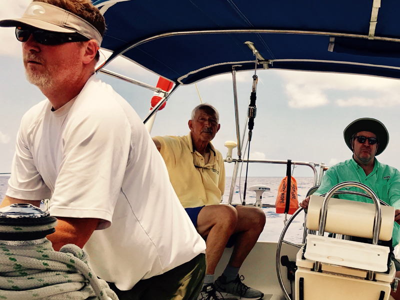
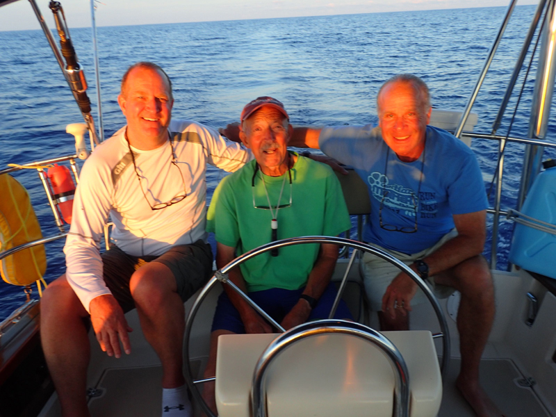
to track this cruise: June 6 to 9, 2017 The following student crew assignments were in
place during the inport preparation days: We also set up training assignments on our weather communications equipment as follows during pre-departure: Joe operating the NAVTEX equipment and receiving the single side band e-mails from Brad as they were available. Matt doing the VHF radio Bermuda forecast and the single side band USCG voice forecast over that radio. Steve doing single side band (SSB-Pactor) Sailmail graphics and text forecast. Adrian was assigned to download from the internet information on the Bermuda forecast graphics and text and the NOAA high speed graphics and texts at Predict Wind and Passage Weather. Once underway, everyone is doing the same assignments with the exception of the information that Adrian was downloading from the internet since we can't get that underway. During our pre-departure training, there was a
lot of wind from the southwest generated by a slow-moving Low pressure system
far to the north of Bermuda. This Low has been causing havoc here. We had 40
knots of wind on June 7 and 8 while we were doing training but we got through it
all just fine. We were planning on departing on the 9 but delayed one day
because of reported wave conditions
near Bermuda in the 9 to 15 foot range with 30 knot winds. So we held off for
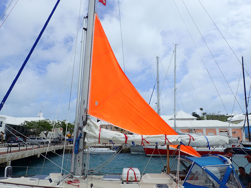
one day and departed Bermuda at 0915 today through Town Cut Channel.
Jun 10, 2017 June 10 June 10 June 10
We just exited Town Cut Channel about 20
minutes ago and we immediately had a rain squall come up and we all got soaked,
since we were slow getting our foulies on. We are out of that now and are
motoring around the east end of the Bermuda reefs and pretty soon we will be
turning toward the northwest to get on our initial track toward Norfolk. We had Dinty Moore beef stew out of a can
expertly prepared by Steve and Matt. Dinner was served at 5:00 pm per the ship's
Watch Bill. This early hour is intended to allow this meal and cleanup to be
completed at an early hour so the evening watches can get to their bunks and
rest before nighttime operations. Jerry and Joe washed dinner dishes in buckets
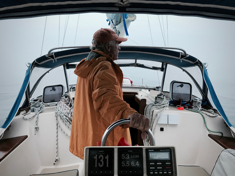
of seawater. At 1830 skies were 90% overcast; winds SSW 8
to 10 knots; boat speed 5.5 knots; seas rolling across from the south at 2 to 3
feet; beautiful evening at sea with comfortable air temperatures. Three working
sails are up including full mainsail, genoa and staysail. Adrian and Tom are
currently on watch for the 1600 to 2000 afternoon watch. Jerry and Joe will be
coming on for the 2000 to 2400 evening watch, and Steve and Matt later for the
2400 to 0400 mid-watch. After clearing the shoals north of Bermuda, we
established a waypoint 30 miles to the SW of the Diamond Shoal buoy on the west
side of the Gulf Stream near Cape Hatteras to be used as a target point with the
intention of riding the Stream to the NE and around Hatteras. That target
bearing currently bears 300 degrees magnetic, and we are able to hold this
course close hauled on port tack. We had light winds most of today and were
motor sailing or sailing most of the afternoon and evening, then by 8:00 PM or
so we started having rain and lightening and we had that on and off through the
night. There is a big Low Pressure system north of Bermuda, quite a ways up in
the North Atlantic, and that just hung around and didn't move, and it had the
Bermuda weather screwed up for the past week. June 11 About 0600 we starting getting squalls and heavier rain than I ever recall seeing for about an hour and a half. The entire seascape was white with the driving down, torrential rain. We were both totally drenched. So we came off our watch at 8:00 AM and Jerry and Joe came on. Naturally it started clearing up for them! We had some on and off showers during the day
today and about 5:00 pm the cold front finally came through and clarified itself
and we have nice cool, crisp, dry air coming from the north now. We've been
sailing very nicely for the last several hours. We are sailing along on a course
of 300 degrees magnetic and making about 5-6 knots. It looks like it will be a
nice evening. We're getting ready to go into the overnight hours and Jerry and
Joe are about to come on watch. When sailing, we are on a four-hour interval
for battery charging and refrigerator operation when we run the engine at 1200
rpm, gear in neutral, for that purpose. June 12 At 0600 winds increased to NNE 8-10 knots; all
sails up; sailing at 5 knots; heading 295ºM; clear skies. This afternoon we again had a beautiful sunny
day. We're about 330 miles from the waypoint SW of Diamond Shoal buoy, which I
talked about yesterday. We're on a course of about 300 degrees and motoring
right now and making about 4.5 knots under motor. Overnight it was beautiful. We
had clear skies with visible stars and moon and comfortable temperatures. This
morning we had a nice wind come in from the north so we had maybe 8-10 knots of
wind and were sailing along very nicely and making 5-6 knots. At other times the
wind disappeared and we motor sailed. So it's been on and off all day. Right now
there is no wind, and the forecast for tomorrow is for little wind. The forecast
from Bermuda yesterday was that a meso-low would form north of Bermuda and would
cause clouds, rain and thunderstorms but we are far enough west that this is not
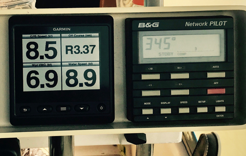
a problem. 2000. Motoring in very light airs. Bright
clear sky. Just passed sunset about 10 minutes ago. Course of 300ºM. Running at
1800 rpm. Making 5.5 knots through the water, but losing about 2 knots to
adverse current based on the GPS speed difference with the water speed. Many
celestial shots completed today by all, and getting some very nice shot
accuracies when compared with GPS position, which is what we do to improve shot
accuracy and shooting technique and to build confidence in one's shooting
capability. Joe and Steve are now below one mile in accuracy, which is very
good. Matt is at about 7 miles, but is very consistent in his results indicating
that his technique is solid, but that he needs to recalibrate his shot picture
image; this will come with a little more practice. Adrian is at about three
miles, and will be taking more shots tomorrow the weather gods willing. Steve
also did a running fix with good results consistent with our DR plot allowing us
to restart the DR plot based on celestial LOPs. We do not see the moon out yet,
but that will come later and it should be a very pleasant evening. We expect the
same conditions tomorrow. At sunset we saw the green flash. Both Jerry
and I saw it. The green flash is when the top of the sun dips below the horizon.
Under certain atmospheric conditions you get a bright green flash for about a
second. It has to do with the refraction of the light coming from the sun
through the atmosphere and it actually breaks the suns rays into all of the
colors of the rainbow but for some reason it's only the green that your eyes
see. I've seen it several times and last night Jerry and I both saw it together.
(See https://www.livescience.com/26376-green-flash.html) June 13 0400: Clear skies. Bright moon. No wind. Motoring at 1800 rpm on a course of 300ºM at about 5 knots. Distance to Diamond Shoal waypoint 274 NM. We had another beautiful day today. Sunny all
day with light winds. We're sailing along now very nicely at about 5-6 knots in
an 8-10 knot breeze, headed towards our waypoint SW of Diamond Shoal. Our course
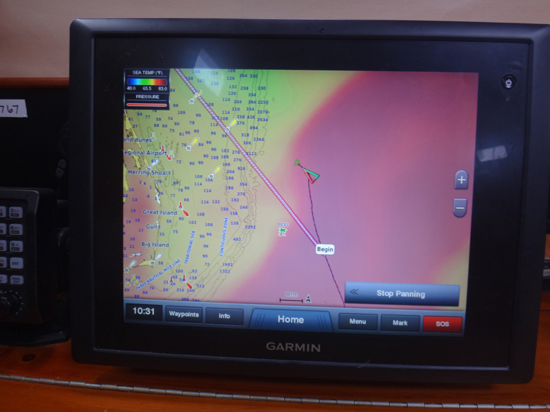
is about 285 degrees magnetic and we have about 200 miles to go to the waypoint. June 14 You may notice on the Spot track that we made
a left turn and sailed on that tack for a few hours to improve our angle on the
Gulf Stream. We have prevailing southwesterly winds and if there is no weather
system coming through, then the further south we get the less chance there is
that we will need to sail close hauled in opposing wave conditions. The winds
this afternoon went from SW to SSW to W and back to SW and that has caused us to
change headings and sail combinations in order to maintain a direction towards
that destination waypoint. So after we went south we were happy to see that when
we tacked back to port tack that we were able to make a heading directly toward
our waypoint. We sailed on that heading for awhile but it was a little rough
because the waves came up, so we fell off a little bit to starboard and had a
softer entry to the waves. We're now hitting them at an angle instead of square
on.
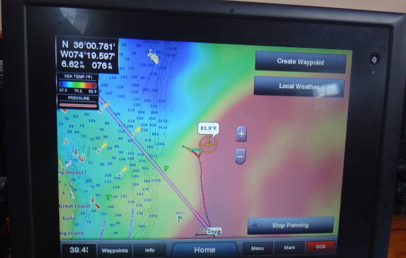
1600: Increasing seawater temperature to 84ºF
along with opposing current indicates that we are entering fringes of the Gulf
Stream. 1900: It was another sunny, beautiful day. We
are sailing on a course now of 295ºM and still heading towards our Diamond
Shoal waypoint which is near the western edge of the Gulf Steam with about 95
miles to go to that point, and we're looking to begin entry to the Gulf Stream
soon. We're reefed down now. We have a full genoa and a double reefed mainsail
and no staysail flying right now. During the day we had everything up, full
main, staysail and genoa, but when the winds came up to 20 knots, we were making
7 to 8 knots through the water. The wind speed has dropped now to about 13-14
knots and we're sailing at 6 to 7 knots. We're prepped with our sails reefed
down for overnight. Right now we have an opposing current of about a knot and a
half so that slows our speed over ground a bit.
No ETA yet. So much will depend on what the
Gulf Stream does to us. I won't really have a good idea until tomorrow after we
have cleared the Gulf Stream. We have a Sirius XM weather continuous feed
into our Garmin system within about 200 miles of the continental US. It gives
forecast graphics showing Highs and Lows, cold and warm fronts, precipitation
and lightning squall areas, wind and wave directions and strengths, and sea
surface temperatures indicating the Gulf Stream actual locations; these are not
the NOAA graphics, but are the Sirius XM interpretations. It also gives verbatim
the NOAA marine zone coastal and offshore text forecasts, which are very
valuable as we approach the coast. 0130: we are being set considerably to the
right of our track by the Gulf Stream current and it looks rather impossible
that we can reach the Diamond Shoal waypoint. So, we completely revised our
course strategy and reset our next waypoint to a position 50 miles to the NE of
the Diamond Shoal buoy. This means that Norfolk will lay to our NW once we mount
the continental shelf, which is ok unless we encounter a new cold front coming
off the US coast that would give us strongly opposing NW winds that we'd need to
battle against. But, such a front is not indicated by the forecasts. So we're on
a course of 337ºM heading toward that new waypoint and being set to the right
of track about two miles per hour by the current. Well, we wanted to get to our waypoint located
about 30 miles WSW of the Diamond Shoal buoy to enable us to cross the Gulf
Stream close to the shoal where the Stream crossing would be its shortest, but
conditions prevailed against us in that regard. We were too far north to allow
achieving that waypoint due to the prevailing westerlies that we encountered
during the previous few days during which we would have needed to sail hard on
the wind close hauled against winds and bow-on waves. Also, we were full-on into
the Stream for the past two days since the morning of June 14, and the NE
flowing Stream had pushed us in that direction making our Diamond Shoal waypoint
all but impossible to reach. So, we bit the bullet and, and on the early morning
of June 15, we set a new waypoint about 50 miles to the northeast of the Diamond
Shoal buoy bearing 335 degrees magnetic from our current position, a course that
we could achieve in the prevailing westerlies. However, even on this course we
could clearly see the effects of the Gulf Stream flow, which set us to the right
of our desired track by a mile and a half per hour. Boat speed plus Gulf Stream
current is putting our speed over ground at 7 to 8 knots.
On the afternoon of June 15 we popped out of
the Gulf Stream as confirmed by lower seawater temperatures, reduced current
effects and the Gulf Stream images appearing on our Sirius XM weather screen.
A few hours later seawater depth reduced to
less than 600 feet as we mounted the continental shelf from the high seas depths
in excess of 15,000 feet indicated by the ocean charts. Shortly thereafter we
ran into dense fog, which persisted the remainder of the day and overnight until
we reached Norfolk and entered the Chesapeake Bay. Also, the wind disappeared
completely and we proceeded under motor directly toward our next waypoint near
the Traffic Separation Zone, which leads shipping into and out of the Chesapeake
Bay. The fog was an interesting challenge, as we had a close encounter with a
cargo ship passing one mile ahead of us (and we could not see the ship at that
close range so dense was the fog) after two-way VHF voice communications with
the ship and an agreed on passing strategy. Our AIS system identified the ship
as it approached more than five miles distant on our port side, but he did not
see us on radar or AIS until we were within 3.5 miles.
After the ship passing we maintained a very
rigid deck watch including radar, AIS, sight and sound throughout the overnight
hours and the morning of June 16 until we reached Norfolk. At 0600 we had
reached the south entry point of the Traffic Separation Zone, but we opted to
proceed outside of the zone and parallel to it toward Cape Henry the southern
entrance to Chesapeake Bay. As we arrived there, we radioed the Virginia Pilots
to advise them of our entry into the Precautionary Zone, where Pilots embark
entering cargo ships for their routes into Chesapeake Bay, and of our planned
route to the inbound Auxiliary Channel on the north side of Thimble Shoal
Channel.
From there we proceeded over the southern
tunnel of the Chesapeake Bay bridge-tunnel and into Little Creek harbor where
the US Navy maintains the Little Creek Amphibious Base and on to our slip at
Cobbs Marina. We also phoned the US Customs office and arranged for entry
clearance arriving from a foreign port, and they said they would meet us at
Cobbs Marina a noon. We also phoned Cobbs Marina to receive slip number and
docking instructions, and by noon we were safely tucked into our slip having
completed an ocean cruise from Bermuda of 816 nautical miles in six days and two
hours, for an average of 134 nautical miles per day.
|


Web site design by F. Hayden Designs, Inc.