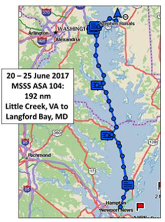
Day 0 – Jun 19, Mon: Arrivals:
Captain. Tom Tursi and his ocean crew returned from Bermuda early Friday
afternoon. The passage left S/V
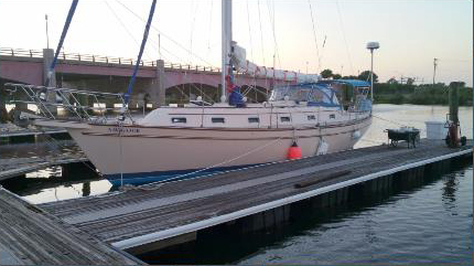
Navigator
in good overall condition from its 1500 nm round trip.
I meet Tom on Sat morning to go over a very short list of issues. S/V
Navigator is almost
ready for her trip north. The crew starts to arrive Monday afternoon,
Frank’s plane, coming in from TX, is delayed but by 5 PM all are aboard.
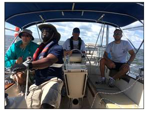
Frank and Charlie are veterans of several courses with Frank having a long
history of sailing on school boats from Fla to VI’s. After all have stowed
their gear, we finalize our cruising plan and develop a supporting meal plan
before heading off for dinner at Capt Groovies.
Dinner provides a good opportunity to get to know each other and
identify individual goals for the class. After dinner Ryan, Frank and the Capt
head to the store for provisions while Charlie and Harold return to the boat
to locate the federal minimum safety equipment.
Once provisions are stowed, we review safety procedures followed by a
below deck orientation before heading to bed. A good start.
Day 1 – Jun 20: Review of Ships Systems,
Rules of Road, Boat Handling, Cape Charles:
After breakfast ashore, we review federal boating safety requirements,
“rules of the road”, buoy systems and coastal navigation procedures and
techniques. Then
it’s on deck for an orientation of deck hardware and
procedures for setting the whisker pole.
Most of the crew have not sailed on a cutter or used a pole so this
trip will provide opportunities to learn new skills.
Once our orientation is complete, we break into our crew assignments.
The goal is to depart for Cape Charles by 1300.
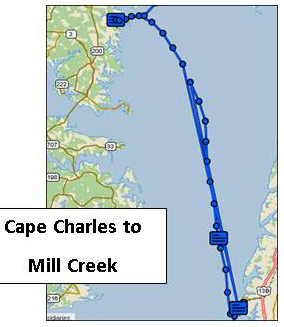
Frank, navigator for the day, lays our course out the harbor, across
the Thimble Shoals Channel and to the entrance to Cape
Charles harbor. Harold and Ryan give the boat a thorough inspection, checking
engine systems, rigging, topping off water and rigging a preventor.
Charlie, Capt for the day, monitors all progress and we are ready to
depart following lunch Before departing we get a wx update – light winds -
and discuss our undocking plan. Charlie gets us past the security at the
entrance to the Little Creek Amphibious Base and into the Chesapeake
Bay. We practice MOB under
power before raising sails. The trip across the Bay provides an opportunity to
get familiar with the boat and the Automatic Identification System (AIS)
allowing us to identify nearby boats by name, course and distance.
Once across the Thimble Shoals Channel, we make slow but steady
progress under sail. Along the
way Frank and Charlie take turns taking two bearing fixes to confirm our
position and make adjusts to our course to account for the light wind and
current. Late afternoon
finds us motor sailing to the Old Plantation Light at the entrance to Cape
Charles harbor and its two ranges or transits.
Using ranges is a new experience for the crew; they see their value as
we navigate the narrow channel into the harbor. Secured by 1730, the crew
enjoys a well-earned dinner ashore. Following
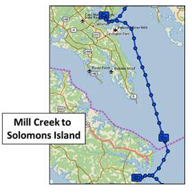
dinner Harold, our navigator for tomorrow, lays out our course to Mill
Creek off the Great Wicomico River.
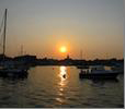
After this long day we turn in for a well-earned rest after a beautiful
sunset. Cape Charles was
once the hub of a busy ferry service to and from Norfolk with both passenger
and rail traffic from 1933 thru the early 1950’s.
Now it’s more “laid back” but a growing center for recreational
and commercial boating.
 |
Day 2 – Wed: Up and Away …. Across
the Bay:
Depart Cape Charles at 0850 after daily pre ops checks and
refueling. Frank, Capt. for
the day, takes us smoothly out the channel and into the Bay where we work our
way round anchored ships and several menhaden “mother ships” recovering
their nets and smaller work boats. The
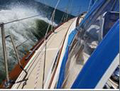
wind is off the port quarter at 15-20 knots; it’s a beautiful sail!
Along the way the crew has a chance to practice taking two bearing
fixes and plotting positions. Harold
monitors our course to take advantage of wind and current and by late
afternoon we are off the entrance to the Great Wicomico River with its
fish traps and crab pots. Careful navigation gets us through the narrow entrance to Mill
Creek bordered by crab pot floats, fish traps and shallows and into a
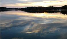
beautiful, secure anchorage. Several
boats from the Capt’s sailing club who have been cruising the Bay for the
past month pass by on their way further up Mill Creek for a raft-up as
we relax in the cockpit taking in this quiet, peaceful spot.
Dinner onboard provides an opportunity to learn more about the skills
necessary for living aboard. Ryan
and Charlie take an opportunity for a short swim - no sea nettles or jelly
fish. After the galley is secure,
we spend time going over knots and review the day’s events.
Ryan, our navigator to for tomorrow, lays out our course which will
require us to round Smith Pint Light and cross the Potomac River. Tidal currents will have an impact on the trip so we spend
time reviewing the use of the NOAA tidal current tables. We have a quiet night
under a clear sky sharing the anchorage with several late arriving boats
before turning in to get ready for tomorrow’s challenges. Distance: 40 nm, max spd:10.2 kts; avg spd:
6.67 kts.
Day 3 – Thurs: North …. always North: Cape
Charles to Mill CreekToday’s destination is Spring Cove Marina
at Solomon’s Island off the Patuxent River.
This will require crossing the Potomac River which in counter
winds and current can be quite “exciting”.
Yesterday we enjoyed a great reach in steady winds, today the forecast
calls for light winds 5- 10 kts with a forecast for the evening and the next
several days of showers and west winds 20-25 kts with gusts to 30.
Yesterday was also the crew’s initiation into one of the “joys”
of sailing in the Chesapeake – crab pots floats and fish traps.
As we depart our anchorage, we find that despite our best wishes they
are still there. My slip neighbor
at Ft Monroe motors by and we discuss the wx forecast, we are headed
north while he will head south attempting to get home before the front passes. Once clear of the now much reduced Great Wicomico Light
and numerous crab pot floats and fish traps, we turn north, round the Smith
Point Light and in the light wind have an uneventful crossing of the Potomac
River. Along the
way we review ASA 104 topics as Ryan tracks our progress as we motor sail
north to Ceder Pt and into Patuxent
River. Ryan gets us safely
into Back Creek at Solomon’s Island.
By 1530 we are secured, pumped out and ready to stretch our legs.
The afternoon and evening is spent swimming in the pool, studying,
planning our tip north to Harness Creek off the South River and dinner
ashore. It’s a nice break from the boat, providing an excellent opportunity
to review the events of the day and discuss future cruising plans. Distance:
43.35 nm; max spd: 8:38 kts; avg spd: 6.12 kts.
 |
 |
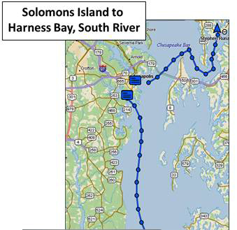
Day 4 Sat: North, …always North:
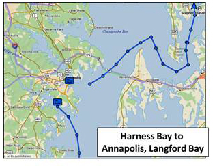
Today our destination is an anchorage in Harness Creek off the South
River just south of Annapolis.
The forecast calls for W winds 15-20 with gusts to 25 kts. Charles
has laid out a course that takes us clear of the crap pots and fish
traps at the mouth of the Patuxent River and the gas offload station by
Cove Point. Once into the
Bay, we take advantage of the following wind and sail wing-wing till we are
able to sail on a beam reach in the gusty winds.
Early on we have put in a reef on the main but it becomes apparent that
a second is called for as we carefully monitor the amount of weather helm.
We have a great close reach for some 30 nms in gusty winds that require
us to reef the genoa and “play” the traveler to keep us balanced and
moving well in these conditions. All
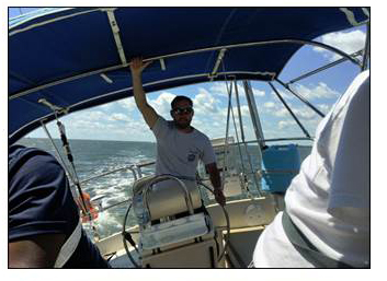
take their turn on the helm and sail trim, gaining a good understanding of the
importance of matching sail size and trim to the changing wind conditions.
It’s a great ride that all will remember as we see the knot meter
showing speeds just short of 9 kts. We take the time to exercise heaving-to in
these conditions and discuss its use in a variety of situations.
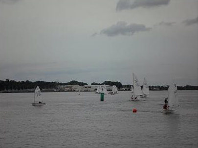
As we have sailed north, an increasing number of boats underway provide
a good opportunity to understand and apply the “rules of the road”.
Based on the radio calls, many boats appear to be headed to Solomons
Island. We enter the South
River in still gusty conditions. Charlie
has a challenge keeping us on course as we weave our way through a field of
crab pot floats and Harold, who has anchored there several times, helps
identify the key landmarks that keep us out of the shoals at the entrance to
the Creek. Once inside this
protected anchorage it lives up to Harold’s description.
The tall, tree lined banks provide excellent protection from the still
strong gusty winds. The Quiet
Waters Park sits to the north with its small boat rentals and walking
trails. A perfect
spot to wait out the passage of a forecasted strong cold front.
Dinner is followed by some swimming, review of marine wx and study for
the ASA 104 test. Based on the wx
forecast, we decide to take the ASA test in the morning here before heading up
to Annapolis. Charlies and
Frank have already taken the test but decide to retake the navigation portion
to validate their navigation skills. Before
dark a large private yacht joints us for the
night. It’s a quiet night in this secure spot despite the strong
winds just around the corner in the South River.
Distance: 43.36 nm; max spd: 8.89 kts, avg spd: 6.12 kts
 |
 |
Day 6: Rain, the Test ….. a little exploring
The plan for today is to take the ASA test, sail up to Annapolis, pick
up a mooring, have lunch and then possibly continue on to an anchorage further
to the north. At 5:30 the
forecasted cold front passes with strong wind and heavy rain which last for
some 45 mins. The wind which had
been from the west now blows from the NE but our anchorage remains the perfect
spot to enjoy the morning, eat breakfast and take our tests.
Shortly after the front passes, a 38 ft Jeanneau sailboat comes into
the anchorage. Whether they were
underway at night or at an anchorage that did not work when the front past is
unclear but we watch them try to anchor for the next 2 hrs.
Each time they attempt anchor, it drags.
We feel sorry for them but letting out the right amount of scope and
allowing time for the anchor to set are keys to successful anchoring.
Raising our anchor calls for a little “encouragement” – it was
well set – but we are soon on our way through the crab pots and into the
Bay. The winds are still strong
and gusty but they provide us a good opportunity to practice all points of
sail, to include jibing with the preventor.
Another day of great sailing! The clearing skies bring out a large
number of boats. Some headed down
the Bay and others to at least three different race courses.
Annapolis is living up to its reputation as a sailing capital.
We work our way through this ever moving sea of boats, crab pots and
fish floats, finally motoring into the mooring field. The bow crew does a good job of getting us secured despite
the gusty winds. The forecast calls for light winds later today so once
secure; we decide that this is not a bad place to spend the night.
After cleaning up the boat, we head into town for lunch, showers, a
little exploring and later dinner at Pussers.
The clearing weather has brought out a large crowd so we are not able
to sit out on the deck for dinner but have a fine view of the busy harbor.
We head back to the boat for an early night.
Tomorrow will require an early departure.
After consulting the NOAA tidal current tables, Harold determines we
should have the current with us for the majority of the trip. Our target is to
be at the Love Pt Light by 0800 tomorrow.
 |
 |
Day 7: Sun: Clean Up and Prepare for Departure
and New Adventures
We are up, pre ops checks complete and moving as the sun clears the
horizon. The forecast calls for light NE winds. Frank gets us out of the
harbor and into the main channel. As
we near the Bay Bridge we check for approaching traffic – all clear. Once
past the bridge, the wind picks up and we have a nice, leisurely sail almost
to Love Pt before the wind dies away so we motor sail around the Love
Pt Light and into the Chester River. We follow Harold’s course past the Kent Island
entrance channel, around the Eastern Neck Island National Wildlife Refuge
and back to the familiar waters south of Lankford Creek.
The wind picks up a little so we attempt some MOB drills but the wind
again turns light. S/V Acadame,
another of the schools boats, is also
returning from a class so we follow them to the marina,
coordinating the use of the fuel and pump out docks. S/V Navigator
has returned to her home port for the first time since early May with 1500
blue water nms under her keel and our 192 nms covered during the trip up the
Bay. We complete our final tasks
of pumping out the holding tank and refueling before returning Navigator
to her slip. Frank
and Charlie have planes to catch so we do a quick job of cleaning the boat and
are all headed home by early afternoon. All agree it has been a great trip
with lots of new skills learned and all expectations met or exceeded. Most importantly, it wetted the crew’s appetites for more.
Well done to a great crew!
Captain Steve Runals
Aboard S/V Navigator
25 June, 2017