|
|
2023 Chesapeake Bay Cruise |
| Home
Purpose Course Descriptions School Yachts Schedule of Courses Ocean Training Cruises ASA Certification Registration Info Our Location Our People Contact Us |
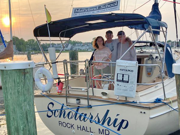
Day 1: After brief introductions, the morning starts out with a review of the stowage plan onboard, safety gear, and ship’s systems, including fuel, water, black water, location of seacocks and strainers, engine and electrical systems. Kelly, Mike and Will were all generally familiar with SCHOLARSHIP from last year when they were aboard for ASA101 and 103, so it already feels a bit like home. After a brief lunch, we review navigation and our options for the cruising itinerary. Tide and current look favorable to pass through Kent Narrows around noon on Day 2, so we start a navigation plan from Langford Creek to St. Michaels. We discuss provisioning options and put together a provision list and daily menu for our time aboard. The students continue to work through the navigation plan while Capt Andy goes into town for provisions. Upon returning, all help to load and stow the provisions onto SCHOLARSHIP. The crew is eager to get off the dock and it is a beautiful evening, so we prep the boat and are underway at 1730 for the short trip to anchor by Joiners Cove in Grays Inn Creek. We set two anchors on a forked moor, one to the south, and one to the southwest in the direction of the predicted overnight wind shift. Engine secure at 1850, then Capt Andy is chef (chicken stir-fry) for the first night. We enjoy dinner in the cockpit while watching bald eagles and blue heron in the nearby marsh. We are also treated with a couple of otter and cow-nose stingray sightings alongside the boat. Tucked in shortly after “cruiser’s midnight” (2100). The wind picked up a bit around midnight and we could hear the anchor rode stretching a bit, but all held well.
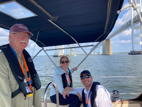
Day 2: Winds S10-15, building to a small craft advisory in the afternoon. Clear. Kelly is skipper today with Mike handling Engineer/Navigation duties and Will serving as Bosun. We go over the navigation plan and plan our departure time to pass through Kent Narrows at either the 1130 or 1200 drawbridge opening. This should coincide with near slack current on the tail end of a rising tide. The narrows is notorious for shoaling and its strong currents, so timing is important. We are underway at 0810 and motorsail with a single reef in the main into the southerly breeze to make good time to the Kent Narrows north entrance. We are slightly ahead of schedule, so take our time lowering sails and heading into the basin by the highway bridge. Observing the temporary navigation markers and favoring the green side, we see a minimum of 6.2ft of water near high tide. As we pass near the sharp bend in the channel, it is evident that there is a strong flood current still running, likely driven by the building southerly winds. Kelly is masterful at holding the boat in position as we wait about 5-10 minutes for the drawbridge to open. We wait for a northbound sailboat traveling with the current to pass first, then throttle up to make our pass. The current is rushing and swirling at the bridge opening, but we pass through unscathed at 1135. Our sistership, ACADAME, is close behind and follows us out into Prospect Bay. There is not much room for tacking down this stretch, so we continue to motor out until Eastern Bay, where we set a single reefed main and jib to sail from G”1P” to RN”6”. We practiced 2-LOP fixes with the hand bearing compass and charts, and established safety depths for tacking back and forth as we head toward the Miles River. The wind is building as predicted, so we take a few turns on the jib furler. The channel is getting tricky, so we furl the jib and motor sail into the Miles River to R”4”, We lower sail and proceed to dock at the Chesapeake Bay Maritime Museum at 1520, with an audience watching from the adjacent slip. Compliments come as the crew executes a perfect waterman’s turn stern-first into the slip. Liberty until 1730, dinner ashore, then review weather and put together nav plan for Annapolis tomorrow before turning in. Day 3: Winds S10-15, gusting 20-25, small craft advisory, scattered showers and thunderstorms, severe storm watch due to approaching cold front. The crew is up early for our departure at 0710 to stay ahead of the weather on our way across the Chesapeake Bay to Annapolis. We motor through the tricky bends in the Miles River until Eastern Bay RN”6”, where we set a double-reefed main and single reef jib. We sail a beautiful close reach, making 4.5-6.0 knots, down the Eastern Bay in 1-2 foot seas, which build as we near Bloody Point. Upon rounding Bloody Point and turning northwest, we are sailing a broad reach in 3 foot seas. The pitch and yaw of the boat are uncomfortable for the crew, so once across the shipping channel, we bear away and run wing on wing toward Tolly Point by the entrance to the Severn River. On the way, we note our time, speed, heading and bearings to Thomas Point Light so we can practice a running fix calculation. We locate R”4” in the Severn, then use eyeball navigation to the “SC” preferred channel marker, where we lower sails and motor into Annapolis Harbor. After a short detour to the pump out dock, we pick up a mooring just as the rain starts at 1330. We put the boat away, then have a break until 1430, when we practiced our running fix and dead reckoning on the chart, followed by lessons on battery and fuel management, as well as tides, currents, waves, weather and dinghy usage. The crew was excited to see historic Annapolis, so we headed to dinner (and ice cream) ashore. Upon returning, a nav plan was put together to get us to Grays Inn Creek, including a bearing to get us through the deceptively tight unmarked hourglass entrance. Everyone is feeling the effects of a long day full of sailing and learning. After a beautiful sunset over the state capitol dome, it’s past cruiser’s midnight and time to tuck in. Day 4: Winds are W 5, predicted to go SSW 5-10 in the afternoon, clear. Will is our skipper today. Weather is good and it’s a leisurely start. Dropped the mooring ball at 0850 and motored due to light winds. It’s time to review various emergencies underway (rigging failure, fire, COB, running aground, etc), passing under the Bay Bridge at 1010. Once safely north of the bridge we have a surprise engine failure drill, and all hands scramble to get the sails hoisted so we would have propulsion and steerage. Winds were now NW at 5-10, G15, so we continued sailing toward safe water mark “LP”. We noted a strong ebb current, so altered our heading about 10 degrees to port to maintain our desired course. We can’t quite point high enough to make “LP”, so figure a reciprocal bearing for a next course and continue sailing our current heading until “LP” is sighted on the reciprocal, then we turn toward the next waypoint off Love Point.
Taking bearings on the Point and a light tower for a two-LOP fix, we determine a need to correct even more to port. The new heading is spot-on as we see our next waypoint, RN”2”, directly ahead - good job navigators! Winds are light and variable, so we go back to motor sailing into the Chester River. The team continues to execute the navigation plan to perfection up the Chester to Langford G”1”. Winds are now S10-12, so we turn off the motor and take advantage of the perfect wind for a lesson on advanced sail trim and twist. Now comes a new challenge … navigating by “feel” using depths to guide us into and a couple of miles up Grays Inn Creek, without any navigation markers, to our marina. We arrive safely and tie alongside at 1630. Showers, then Taco Tuesday dinner aboard! We are entertained once again by eagles, heron and osprey. Time for relaxation and some last minute review in anticipation of the written exam tomorrow. Day 5: S10-15, G20, cloudy, PM showers. Underway at 0850. Departure is tricky with the wind working against us and low tide making the channel very tight. We use a doubled back spring line off the bow and kick the stern out to pivot the boat a full 180 degrees while still attached to the pier. It’s a short trip back to Lankford Bay Marina, but beautiful sailing conditions! We work our way out of Grays Inn Creek under full sail, making up to 7 knots, before turning the corner and running alternately on a broad reach and wing on wing all the way past day mark G”7”. We lower sails outside the marina, then stop to take on fuel and pump out and we are docked in our home slip at 1150. Lunch, then top off the water tank and clean up the boat before heading up to the classroom for the written exam. All do well. Time to reflect on a successful 100nm cruise filled with nature, history, sailing and of course, many lessons learned - well done Kelly, Will and Mike! Captain
Andy Barton
|
Web site design by F. Hayden Designs, Inc.

