|
|
2017 DELMARVA Reports |
Home
|
Saturday, July 21,
2017: Pre-departure Preparations Days 1, 2, 3 –
DEPARTURE EVOLUTIONS: Lankford
Creek to Swan Creek Thence to Summit North Marina and Delaware River Once underway and on our first leg (from Lankford Bay down
the Chester River and into Swan Creek), we practice boat handling, compass
steering and traditional navigation. The captain and crew, using Chart 12272,
concentrate on nav plan development and procedures while captain Tom shows the
crew how to use our complex but user-friendly electronics. In Swan Creek, we
find the anchorage already crowded and need to search before finally dropping
the hook and can enjoy a simple dinner in the cockpit. On our way to the Chesapeake and Delaware Canal the next
day, and with charts 12278 and 12274 as our guide, we first practice crew
overboard (COB) procedures under sail. Next, we establish rotating watch
routines needed on a long voyage (navigator, lookout, helm, deck hand/engineer).
Knowing these specific duties will make it easier for crew when they take on the
role of “Skipper-of-the-Day” from noon to noon later. Commercial traffic
nearby prompts us to review the “Navigation Rules” and assess tides and
currents. Ray who is taking a DELMARVA 106 as a refresher provides helpful
perspectives. Entering the Canal and then Summit North Marina provides another
challenging experience. The heavens had opened up all around us and kept the
fuel dock closed for safety reasons. Dinner and shower ashore restored us. Our departure down the Delaware River (Charts 12312, 12311)
was delayed because we waited for the fuel dock to open. Yet, this leg is
providing the fullest training experiences so far. The captain establishes the
navigational watches as follows: 1200-1600/Midnight-0400: Jeff and John (Captain, then First Mate on call at night) 1600-2000/0400-0800: Tom and Ray 2000-Midnight/0800-1200: Janet and Jochen While the Captain introduces the watches to Tabular Log,
Boat Check, and other watch routines, First Mate introduces the fully integrated
nav plan which utilizes charts, Light List (here, Vol. II), and the
Multifunctional Display (MFD) plus waypoint (wp) list. As one more significant point, current set and drift, our
careful, ATON-assisted exit from the Canal in a strong current was contrasted by
magnified steering efforts required in cross currents as the Captain
demonstrated a “Harbor-of-Refuge” landfall through the Reedy Is dike.
Similar attempts at night would require even greater efforts or be avoided Lessons learned
include: 1) To steer a straight course in a variety of conditions, “steer
small” i.e., straight arms high on the wheel to minimize exaggerated wheel
(and boat!) motion. 2) Leave time margins: a) when arriving late in a crowded
anchorage, or b) when entering a marina and expect service. 3) Currents can
spell disaster for the unwary mariner. 4) Use “all available means” to
safely navigate. Days 4, 5 – Ocean
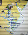
Transit: Delaware Bay Thence Offshore to Cape Charles Harbor, Chesapeake Bay
Entrance Our navigators had picked as departure point from the
Delaware Bay the NW perimeter buoy G “5” Fl G 2.5 s Gong of the charted
Pilot Area which lies just E of Hen and Chickens Shoal. While gazing at a hazy
sunset and cumulonimbus clouds building all around, we have a simple meal in the
cockpit and discuss tonight’s weather report: SSW 10-15 (i.e., almost on the
nose), seas 2-3 feet, a cold front and Low center just to our north. Since the
front is to pass through, we keep one reef in the main sail (preventer in
place), furl the genoa, and set the much smaller staysail. With the wind
freshening to 15 knots and now sailing the wind angle, the best we can do is
plotting a course of 148ºT that will eventually take us 30 miles offshore. No
helpful cross-track error usage here. At 0230 the midnight watch (Jeff, John) receive a VHF call
from a nearby naval vessel alerting us that they had just clocked a sudden gust
at 40 knots. The front would reach us next. Within minutes, Jeff, wrestling the
wheel, correctly called for backup. By the time the Captain arrived to assist,
the wind had backed, forced an accidental jibe against the preventer, and we
were heading almost north. Jeff, with engine throttle assist from the Captain,
gets the boat back on course. The wind would back us two more times, sending
driving rain before valiant Jeff can breathe easy. A look later at our weather
display showed that the Low center with its counter clockwise movement had
passed overhead and accounting for the erratic wind directions. By 1030, the wind having clocked west, we are and 30 nm E
of Assawoman Inlet (Chart 12200) we can finally tack and set course for R
“2N” Fl R 4s, our North Channel landfall buoy at 37º19.150’N; 075º54.22W.
As the skies clear, John who had already taken the ASA107 Celestial Navigation
class, breaks out his sextant and starts taking sun shots. He’s having fun. At nightfall, sails down, our target buoy marking the
entrance to the North Channel through Fishermans Island Bridge (shown on Chart
12221 as CHESAPEAKE BAY BRIDGE TUNNEL TRESLE D) is in sight. Tom and John had
broken out the Light List and had plotted a precise course up the marked
channel. But buoy R N “8” along our way is nowhere to be seen. But the
critical turning buoy R N “12” does come in sight. We discuss our vessel’s
“air draft” (52’) and conclude that Navigator’s
mast plus antenna could safely transit under Fishermans Island Bridge with its
charted vertical clearance of 75ft. All agree, that we can pass safely. With
lookouts on either side, spot lights at the ready (it’s now full dark), we
line up the green center-channel lights overhead and with a 2 knot current on
our tail, we are safely through. Two more hours bring us to the Cherrystone Channels A and B
of the Cape Charles Harbor approach and the Captain – Tom expertly docking the
boat – guides us to the unlit, ghostlike marina. It is past midnight. All are
tired, but mighty proud about having managed a good landfall. Lessons Learned
Include: 1) Departing for sea and making landfall should, ideally, be
accomplished in daylight. 2) Severe, blinding squalls can disorient the cockpit
crew, especially at night. Prepare for the squall by dousing the headsail,
reefing the mainsail, and securing all hatches. Follow wind as it clocks around
keeping the wind at 50 to 60 degrees apparent to prevent wind from going astern
and causing a gybe. Use foredeck lights to make sails visible. 3) Use “all
available means” to ensure safe transit and landfall. Days 6, 7, 8 –
Landfall Evolutions continued: Northward on the Bay to Home Port
With tug-and-barge traffic all over the Bay at night, two
encounters stand out. While motor-sailing on a course of 011ºpsc and at an
angle toward Rappahannock Shoal Channel (Chart 12226), Janet notices lights
possibly moving against the backdrop of shipping anchored in the Quarantine
Anchorage W of Cape Charles Harbor (Chart 12224). There appears to be no AIS
vessel in the Channel when “Car Carrier PARSIFAL’S” hails us on VHF Ch
16/13 to enquire about our intentions. We alter course immediately to the E and
clear the channel well ahead of her. “PARSIFAL’S” response to our
intention and maneuver: “you are fine.” The second encounter happened while the Captain was at the
nav station and First Mate having the con, when both NAVIGATOR and
a tanker approach the Bay Bridge on a converging course. First Mate makes
contact with the tanker by VHF to agree on safe passage only to get the curt
response “We will cross under the Bridge.” and makes the prudent decision to
slow down and cross behind the tanker saving nerves of all around. Docking in Annapolis City Dock at 1230 left ample time for
students to take their ASA-106 test (all pass with flying colors), and for First
Mate - noticing reduced engine cooling water flow - to inspect and replace our
engine sea water impeller. Showers ashore and a delicious Italian dinner rounds
out this eventful but rewarding sail up the Bay. By contrast, the final leg back
to our marina in calm winds left time for conversation and reflections. Of
course, mundane close-out chores – pumping out, fueling, docking, cleaning –
had to be accomplished, too. That done, we bid each other a fond farewell. Lessons Learned
Include: 1 a) Consult AIS list on MFD, as needed, and zoom in on Chart
Plotter to reveal details of narrow channel and possible AIS vessels therein; 1
b) Hail distant shipping in channel to verify safe passage, cross channel at
right angle and in ample time. 2) Cross behind nearby shipping to reduce risk.
Well done, my friends. Your captain and captain Tom salute you – with thanks and appreciation. Fair Winds to you, always. Captain H. Jochen Hoffmann |
Web site design by F. Hayden Designs, Inc.


