|
|
2017 DELMARVA Reports |
Home
|
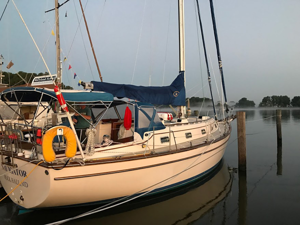
Pre-departure
Preparation: All tasks are completed before our students begin arriving
during the afternoon of September 16th. Once they are aboard and gear stowed, we
review the ASA106 standards, inspect personal safety gear and have dinner
ashore. Despite Rock
Hall being crowded, we find a relatively quiet place at the Harbor
Shack and continue getting to know each other over a very satisfying diner.
Back aboard, we get a weather update on Hurricane
Jose’s forecast track, and discuss marine weather.
The uncertainty of the track leads us to decide to spend tomorrow in port
rather than departing the marina for an anchorage near Rock
Hall. An early bedtime is a
welcomed end to the day. Saturday: Day 1
– Finalize boat prep and detailed navigation planning: Doug then works with Captain Tom to develop our navigation
plan for the leg from Swan Creek to Summit
North Marina in the C&D Canal.
Both spend time carefully reviewing the USCG Light List and Local Notice
to Mariners to ensure they have the latest information. After completing other
preparation tasks, John and Marvin support the navigators by working up tide and
current projections for the legs to Swan
Creek and Summit North. The extra
time for planning provides an opportunity to work each area in detail.
We finish in time to review several sections of the school’s offshore
planning book before heading ashore for dinner.
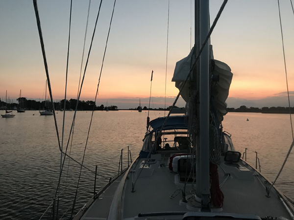
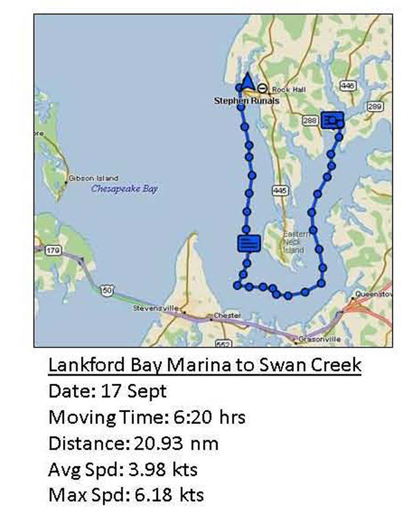
Day 2 - Lankford
Creek to Swan Creek, Rock Hall On this early fall evening the anchorage is not crowded but
we do share it with several other boats. We
enjoy a simple dinner while discussing the day’s events followed by a little
knot tying practice. Hurricane Jose’s
track is still a concern but we decide to head up to the C&D
Canal to be in a position to take advantage of any improving weather.
Doug updates his navigation plan to determine our best departure time.
He has to balance sun rise for visibility, the tide over the Swan Creek Bar, current in the C&D
Canal, which can be very strong, and a desired arrival time at the Summit
North Marina before dark and before the fuel and pumpout dock closes.
His planning leads us to determine that we should depart by 0730
tomorrow. We will encounter an ebb current on the way north but by arriving at Old
Town Point Wharf at the entrance to the C&D
Canal we should have a favorable current to Summit
North. A quiet, cool night with light winds makes for a welcomed rest.
Moving time: 6.20 hours; distance: 21 nm; average speed: 3.98 knots.
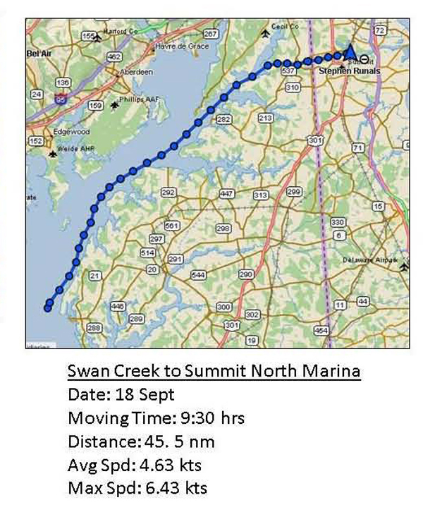
Day 3 – Chesapeake
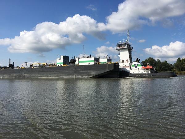
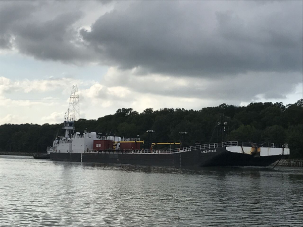
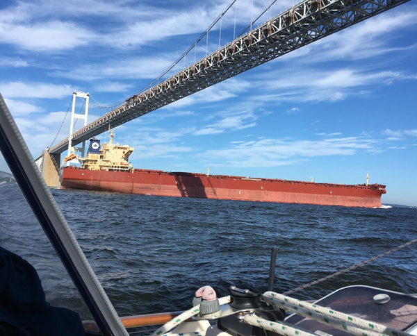
and Delaware Canal, Summit North Marina: Once across, we motor sail north and practice watch keeping and related tasks in one-hour shifts. All get a feel for a combined use of traditional navigation and S/V Navigator’s electronic aids – chart plotter, AIS (Automatic Identification System) and radar. The wind remains on the nose and we stem an ebb current but make steady progress. Along the way we pass many sail and power boats headed south to avoid Jose. Doug tracks our progress to help ensure we arrive off Old Town Point no earlier than 1500 hrs and no later than 1600 hrs so we can have a favorable current in the C&D Canal all the way to Summit North. Despite working around crab pot floats, fishing lines and a southbound tug and barge, we arrive within our scheduled time window. The sun is out, the temperature cool as we make our way along the canal. AIS identifies two tugs and barges we will meet along the way – one east bound and the other west. We encounter both in what now becomes a very narrow canal. We arrive at the Summit
North Marina, refuel, pumpout and are secured in a slip by 1730.
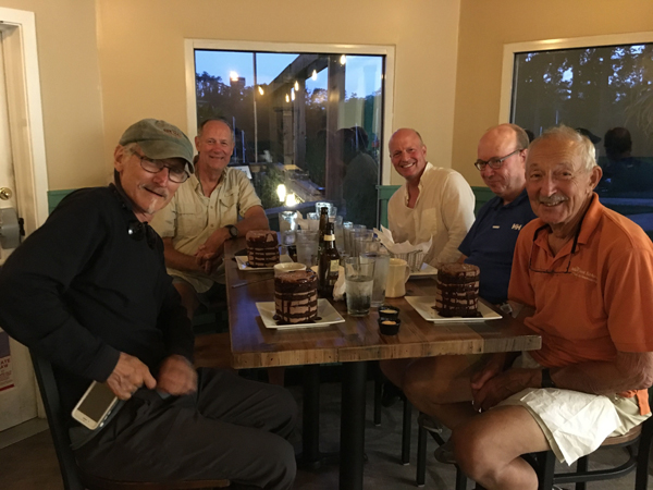
Before heading ashore for dinner we check the forecast for Hurricane
Jose. Based on its track and
the resulting wind and sea conditions we decide we should wait out our departure
south here for another day. The new
restaurant Grain H2O proves to be an
interesting place. Of note is their one desert - chocolate cake, a treat that
will not be forgotten. We complete our pre-departure checks, top off water,
review watch standing procedures and check personal equipment before enjoying an
early bedtime. Moving time: 8.22 hrs; distance: 39 nm; average speed: 4.63
knots.
Day 4 – Detailed
planning and the “test”: Tomorrow's conditions should be in our favor.
Once our navigation planning is complete, the crew spends some time
studying for the ASA106 test. All
then take and pass the test and we celebrate with a fine pizza/salad dinner,
followed by some time at Grain H2O
for something to drink. We plan an
0930 departure tomorrow so we enjoy some time discussing the day’s training
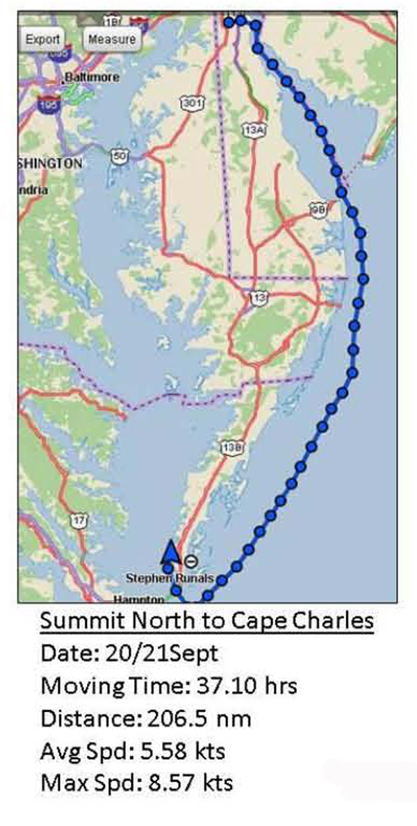
before turning in for the night. Day 5/6 – Summit
North Marina offshore via Delaware River to the Chesapeake Bay Entrance and Cape
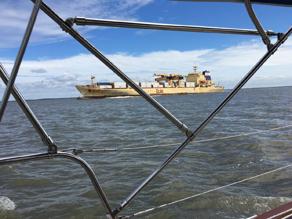
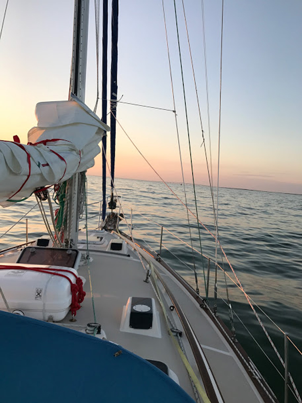
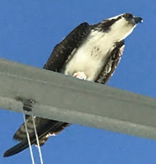
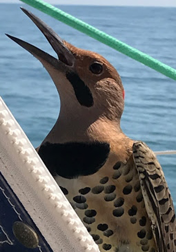
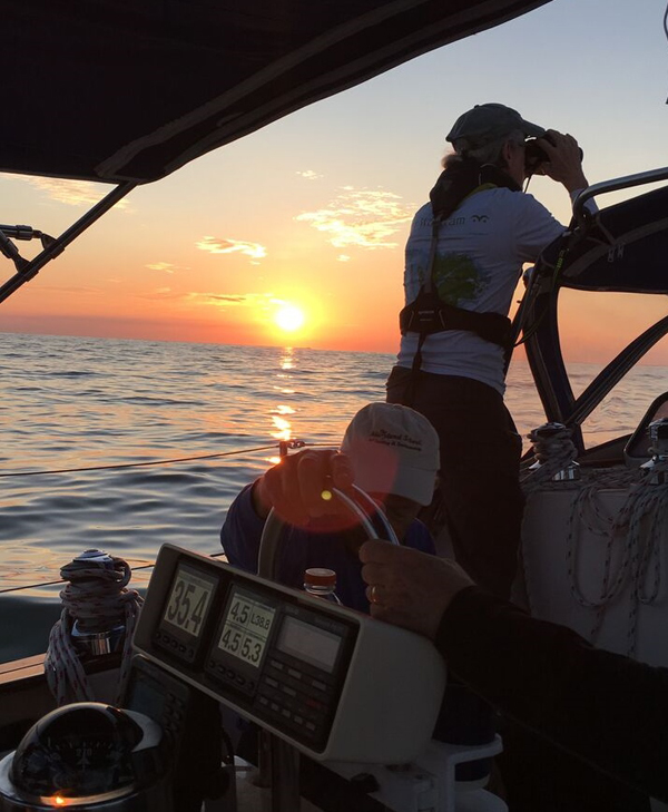
Charles Harbor: As we approach the entrance to the Delaware Bay traffic begins to pick up and a steady stream of ships pass northbound. The wind begins to drop and by the time we change watches at 2000, it has fallen away. A persistent east swell left over from Hurricane Jose is all that remains of the storm. Despite the light winds, we put a reef in the main prior to sunset as a precaution against unexpected and unseen winds. The next day Tom uses our time underway to explain the fine points of using plotting sheets and keeping a DR plot. We have an uneventful passage except for three things – the eastern swell, biting black flies which become extremely annoying and several feathered passengers that come aboard to share the ride. Some stay for a short time, others come and go over several hours. Unfortunately this is not the case with the flies; they stay with us until we get to the northern Chesapeake Bay. The lack of a
moon provides a star filled sky during the night watches.
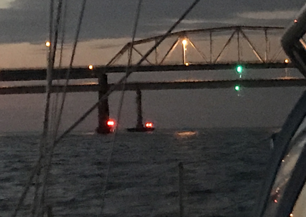
Late afternoon the next day finds us at the entrance to the Chesapeake
Bay. It takes a little effort
to find the key approach buoy 2N but a vigilant crew soon identifies it and we
work our way up the North Channel and
its bridge in the fading light, keeping a sharp lookout for the unlighted
channel buoys. We are under the
bridge and into the Chesapeake Bay by
1930. John takes us north to the Old
Plantation Light at the entrance into Cape
Charles and we carefully work our way into the Town docks. Captain Tom
tracks our progress down below on the chart plotter, the crew keeps a lookout
for unlighted buoys and John at the helm, carefully follows steering guidance.
Entering Cape Charles at night
requires a team effort. By 2030 we
are secured to the dock and ready to head up to the Shanty to celebrate our successful passage. Moving
time: 36 hrs.; distance: 202 nm, average speed: 5.58 knots.
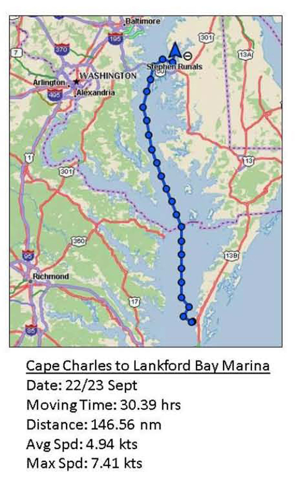
Day 7/8 – Cape
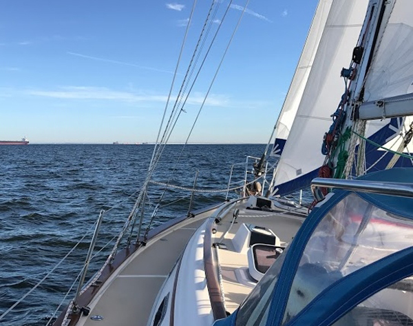
Charles Harbor to Lankford Bay Marina: Watch keeping takes on increased importance as we work our way north crossing the major shipping channel several times, avoiding north bound shipping. North and southbound shipping traffic increases significantly after dark and north of the Potomac River. AIS does its job providing early warning of the approaching traffic that will become 9 ships or tugs pushing/pulling barges passing us between 2100 and 0700 hours. Some pass very close and require confirming passage plans over VHF Channel 13. We keep in mind that not all vessels have AIS and floating debris, buoys, crab pot floats and other things do not show up on AIS. An alert watch is essential always and is especially important in this high traffic area. In between this flow of traffic we execute our MOB practice. While we quickly recover our lighted MOB float, all see the importance of staying on the boat and the difficulty of recovering an MOB at night. Sun rise finds us off Knapps Narrows and a building NW breeze. We continue to motor sail but with all sails flying to keep up our speed. As we pass Annapolis, the Severn River is filled with white sails and power boats – lots of folks out enjoying the sun and fine 8 to 10 knot breeze. Once clear of the Bay Bridge, we fall off toward Love Pt and enjoy a perfect sail under a blue sky without the motor. Around the Love Pt Light, we fall off to a run and rig the whisker pole and preventer. It’s a short sail as the wind falls off again. We make our return to Lankford Bay Marina under motor, and arrive back at the marina in time to refuel, pump out and tie up in our slip by 1430. It has taken us almost 29 hrs to travel the 142 nms from Cape Charles, a slow but steady trip that has reinforced the importance of keeping an alert watch, working as a team, monitoring weather and traffic and adjusting our plans to account for changing wind and sea conditions.
Before departing, we clean the boat inside and out and
conduct a course review. It’s
been a good trip with a good crew and all have learned much, not only improving
individual sailing skills but about themselves.
All look forward to the opportunity to apply newly developed skills in
their own sailing and look forward to sailing together again. Well done fellow mariners. I salute you – with thanks and
appreciation. Fair Winds to all.
Captain Steve Runals
|
|||||||||||||||||||||||||||||||||||||||||||||||||||


Web site design by F. Hayden Designs, Inc.