|
|
2018 DELMARVA Reports |
Home
|
Pre-departure
Preparation Our student crew Mike and Taylor plus our first mate,
Captain Robin Bauer, arrive during the afternoon of September 14, and we start
immediately with initial introduction to systems below. Over dinner at Bay Wolf
restaurant, we get to know one another and preview our upcoming cruise. In fact,
our preview had begun weeks earlier with an on-line meeting and preplanning
assignments focusing on key components of an offshore passage. To this end,
students had looked up charted hazards, tides at key points, bridge elevations
and navigation lights protruding down from bridge girders, harbors of refuge, USCG
Light List (LL) entries for crucial departure and landfall waypoints, etc.
Weather analysis would come later. Saturday, September
15, Day 1 – In Port at Lankford Bay
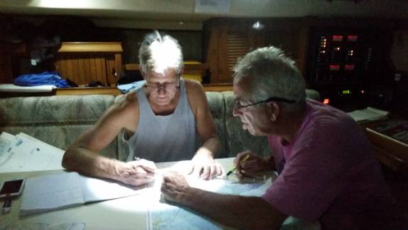
Marina We start the day inspecting personal gear, lines, sails, and winches above deck, and systems and equipment below, including NAVIGATOR’s safety equipment. That includes deploying and furling all sails properly, rigging and derigging the whisker pole, and getting to know windlass plus engine operations. Next, we break out charts, the USCG Light List, U.S. Coast Pilot Vol. 3, the essential NOAA-Chart No 1, plus navigation tools. We use all of these to develop our first navigation plan from Lankford Bay down the Chester River and into Swan Creek near Rock Hall. All waypoints, courses per TVMDC calculations, Light List and Coast Pilot findings are entered consecutively in our Deck Log. That done, and looking ahead, the first student skipper, in this case Taylor, to be followed tomorrow by Mike, begins his assignment at 1800 hours today.
Day 2 –Lankford
Bay Marina to Swan Creek With the wind NW 12-15 knots, the crew sets sail and
follows the nav plan, but also practices tacking maneuvers and MOB drills under
sail as we round the horseshoe bend of the Chester River. Now, sailing
close-hauled and steering 030ºpsc (per ship’s compass), we start practicing
bearing fixes using charted objects. Mike - who has chartered out of Swan Creek
before - pilots us to our anchorage where we practice setting two anchors. First
mate Robin shows how to perform an anchor watch by taking bearing fixes and
performing periodic watch routines. After a quick, simple dinner, all of us
collaborate in generating a proper nav plan for the next day. We identify key
waypoints along the shipping channel of the Upper Bay, list them in the deck
log, measure course lines and distance, calculate TVMDC values to plot them on
the chart and give appropriate helm orders and, finally, look up the latest
Local Notice to Mariners to ensure that our chosen buoys and beacons have not
been damaged or dislocated. As a
final step, we enter our chosen waypoints in the chart plotter consecutively so
that we can call them up tomorrow as we navigate north. Day 3 – Swan Creek
to Summit North Marina, Chesapeake and Delaware Canal The first mate calls ahead to both Summit North Marina and
Cape Charles Harbor to arrange for slips. We dock in Summit North in ample time
to have dinner ashore, shower, and develop the next day’s navigation plan. The
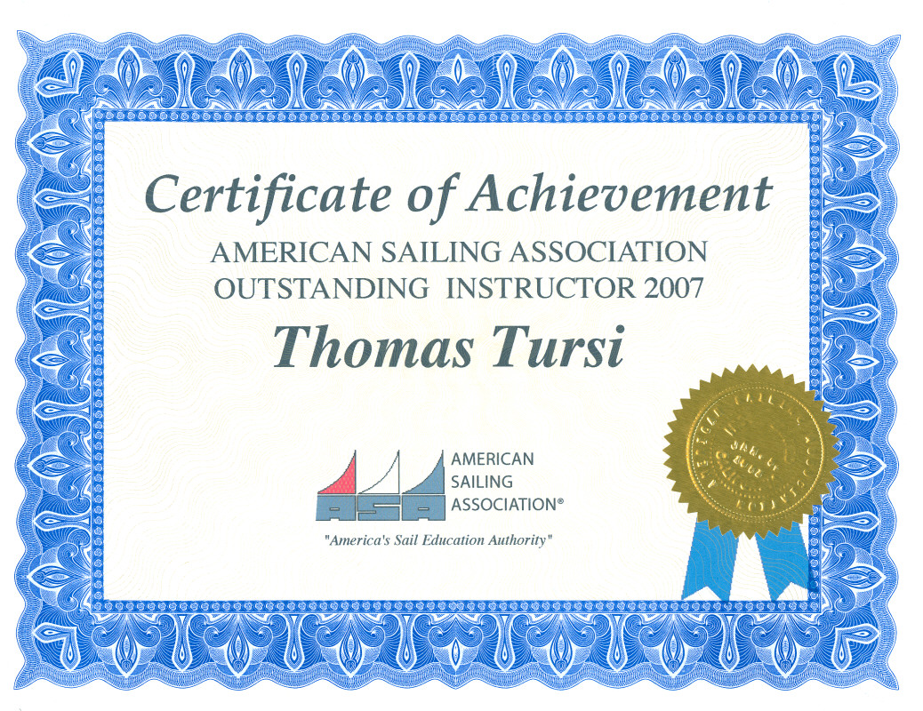
captain has one more weather review with Tom Tursi ashore and both conclude that
the perimeter winds from Florence, the restricted visibility and potential for
fog call for a one-day delay plus an extra pair of eyes and hands for the two
overnight legs, so Tom offers to join us tomorrow evening in Summit North as
supernumerary for the remainder of the cruise, which is a most welcome solution. Day 4 – In Port,
Summit N Marina We clean the boat, spend the day developing a detailed nav
plan from our current position via the Delaware Bay and coastal Atlantic ocean
to the Chesapeake Bay, and the student crew takes the ASA106 test. At 1700 Tom joins our crew for a dinner together
and an early night. Day 5 – Summit
North Marina to Offshore via Delaware River and Bay
The student crew is taking turns steering and becoming
familiar with overtaking and oncoming tug and barge traffic. Once in the
Delaware River and following our nav plan, we stand down from “all hands”
and begin our six-hour watch routine as follows: Tom and Mike: 0300 to 0900 and 1500 to 2100 We need to motor all the way down the narrow Delaware River and most of the Bay with wind from the north at 10 and on our stern. As the wind clocks more to east, we raise the main and genoa and continue on motor sailing. Starting at Brandywine Shoal, and using DMA Plotting Sheet 925, we introduce DR (Dead Reckoning) conventions to familiarize the student crew with procedures used offshore by distance sailors. Robin had earlier marked the lat/long for our departure buoy from the Delaware Bay, namely the NW perimeter buoy G “5” Fl G 2.5s Gong of the charted Pilot Area which lies just E of Hens and Chickens shoal. From there, she had also entered a danger bearing of 163º True or 171º psc (per ship’s compass). In short, the helm order was: steer nothing less than 171º psc. As it turned out, the wind remained fair and both watches were able to sail close-hauled at about 165º psc.
Day 6 – Offshore
to Cape Charles Harbor, Chesapeake Bay Entrance Until noon, we have some delightful sailing conditions. We
are nearly 30 nm offshore, and it’s time to set course for the Chesapeake Bay
entrance at the North Channel through the Fishermans Island Bridge (shown on
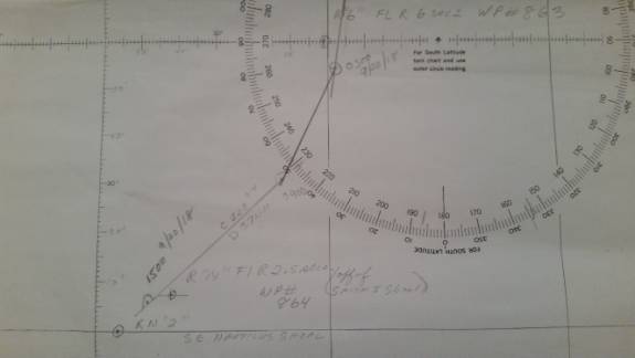
Chart 12221 as CHESAPEAKE BAY BRIDGE TUNNEL TRESLE D). Our approach mark is buoy
R “2N” Fl R 4s, south of Nautilus Shoal at 37º 19.150’N; 075º 54.22'W.
We discuss our vessel’s mast height of 54 feet above the water plus 3 feet for
the VHF antenna, and conclude that we can safely pass under the Fishermans
Island Bridge with its charted vertical clearance of 75ft. As we get closer, we
motorsail along the approach buoy’s latitude line of 37º 19.150’N and watch
the numbers on our handheld GPS. All agree with the strategy, and with lookouts
shining flashlights on both sides (it’s now full dark) we pick out the channel
buoys as the bridge ahead and its center nav lights below the steel girders loom
larger and larger. After passing through the two bridges, we follow our nav plan
into Cape Charles Harbor Marina where Tom docks the boat before we all get a
good night’s rest. Day 7 – Cape
Charles Harbor to a night-run up the Bay We cast off at 1530, top off fuel and pump out at the fuel
dock, and by 1630 we navigate down the Cherrystone Channel and out into
Chesapeake Bay. Once outside the entrance, with winds of 10-15 knots from SW, we
set the mainsail (one reef still in place) and rig a preventer. It’s a perfect
wind angle to rig the whisker pole for the remaining daylight hours before we
unfurl the genoa. A three-quarter waxing moon under partly cloudy skies makes
this a delightful run. By the time we are about to cross the Rappahannock Shoal
Channel, we receive a VHF call from a large freighter that is not showing on AIS.
She is alerting us that she’ll be entering this channel shortly and requests
that we move west of the channel and away from where she needs to pass. We of
course comply with this request and confirm this with the freighter. After we
clear the channel, we can make out her lights in the distance, and she
eventually overtakes and passes to our starboard side. Day 8, East of
Tangier Island to Lankford Bay Marina, We are now motor sailing on a broad reach, preventer
rigged. With the moon hidden behind clouds, the tired crew is challenged to
minimize cross-track error and not jibe the boat. Off Annapolis by late afternoon and with decreasing winds
on the nose, we drop all sails and motor along our pre-planned waypoints. As we
approach Love Point and then enter the Chester River in evening twilight, we
adjust our waypoints on the plotter for an extra margin of safety. For good
measure, we use spotlights to find and identify buoys to ensure that we are
where we are supposed to be. Once back in our marina, the captain maneuvers NAVIGATOR
to the pump out dock to empty our holding tank, and Tom takes her back in to her
slip - with big smiles all around. Although it’s getting close to midnight,
Mike wants to “hit the road” for a few hours to shorten his long drive the
next day. After breakfast on Sunday, we tidy up a bit and offload our gear. That
done, we bid each other a fond farewell and best wishes. Well done, my friends. Your captain and first mate Robin
salute you – with thanks and appreciation also from Tom.
Fair Winds to you, always. Captain H. Jochen Hoffmann
|
Web site design by F. Hayden Designs, Inc.