|
|
2021 Bermuda Reports |
| Home
Purpose Course Descriptions School Yachts Schedule of Courses Ocean Training Cruises ASA Certification Registration Info Our Location Our People Contact Us |
6/6 Sunday 6/7 Monday
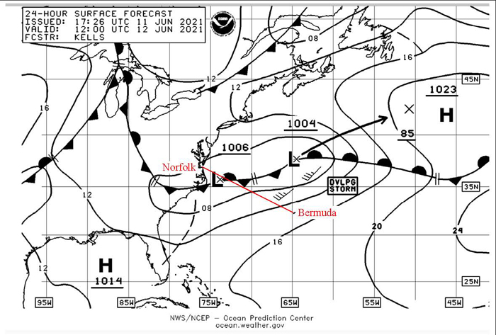
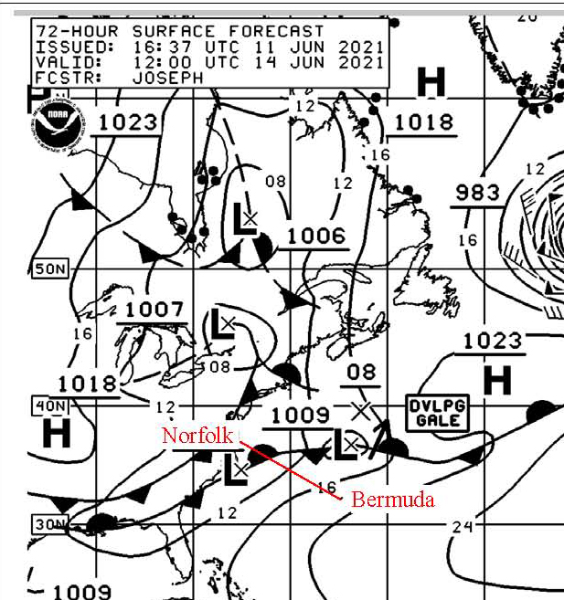
6/8 Tuesday Meteorologist Bradley Mabe provided the following weather forecast for the next few days: 6/9 Wednesday- Winds S to SSW 7-12 becoming more SW at 10-15 in the evening possibility of scattered showers 6/10 Thursday- Winds SSW 10-15 in early morning becoming more WSW in the afternoon. Winds are stronger approximately 40 to 60 miles N of BDA at 15-20 knots. 6/11 Friday- Winds SW to W at 15-20. A short wave trough from the NW will bring stormy conditions. At present, the possibility of SW 25-30 across your anticipated course track. A Low-pressure system expected to form 75 miles E of the NC-VA border with movement generally ENE. Expect rain and t-storms to increase during the afternoon and evening. At this time a more southerly route looks better, but still contains rain and stormy conditions. 6/12 Saturday- Stormy conditions continue into the afternoon.
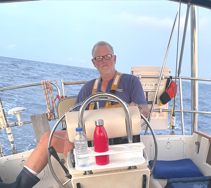
6/9 Wednesday We departed Bermuda at 1030 EDT. Winds SSW at 7 knots.
Today skies were overcast, gradually clearing by late afternoon. We are
motorsailing close hauled with mainsail and full Genoa making 5.5 knots on a
course of 295 per compass toward a waypoint located five miles SW of Diamond
Shoal red buoy 12. Position at 2040: N3241, W6530. Watches are: Karl & Kyle 12
to 4; Tom & Charles 4 to 8; Frank & Harry 8 to 12 both AM and PM. Towards evening, we passed PRIDE OF BALTIMORE
heading east to Bermuda on a reciprocal to ours. Spoke to them briefly by VHF
radio to establish a passing agreement, which was port to port at one mile
closest point. Karl and Kyle prepared Chili and rice for first nights dinner...
Delicious!
6/10 Saturday 6/11 Friday When hove to we are still an underway vessel and will
continue with regular underway watches. Off watch crew will be working on their
ASA108 onboard tasks and other lessons, including boat cleanup per First Mate
Frank. Tom cooked cheese omelets for breakfast. It occurred to me
that we were a little floating island of civilization in this wild and woolly,
squally seascape flipping eggs over a propane stove!! At 1015 we secured the heave to, unfurled the staysail and
sailed with reefed mainsail and staysail on a course of 310 per compass giving
an apparent wind angle of 60 degrees on port tack and a modestly good angle to
the approaching waves; sailing was hard with periodic boarding waves into the
cockpit. Boat speed 3 knots. Hard on crew. Winds to 20-25 SW. At 1315 hove to
again, this time with an improved apparent wind angle of 50 to 60 degrees and a
good angle to the approaching waves. Smoother ride; easier on crew. According to
weather forecasts, these conditions will last for another day or more and
probably worsen by tomorrow, so I expect to remain in this position for a couple
of days and will definitely be delayed arriving at Norfolk. At 1900 wind and waves calmed a bit so we got underway
again with reefed mainsail and staysail on a course of 310 degrees per compass toward
Chesapeake.
6/12 Saturday
During the squall, Karl and Kyle spotted ship lights dimly
lit through the heavy rain. Ship did not show AIS signals but did show up on
radar at two miles distant. By this time we could see her both white range
lights spread apart with lower light to our left view indicating the she was
crossing our stern from our port to starboard side and radar showed her distance to
be increasing and safely passing. At the time we thought it rather unusual that
a large commercial ship was not transmitting an AIS signal. Position at 0900: N3415, W6849. This morning, winds and
waves continue as before the squall, but by 0900 clouds are thinning and the sun
peeked through for a brief moment. Weather forecasting indicates that conditions
will not improve significantly for the next two days, but we will sail toward
Chesapeake as conditions permit. ETA currently undetermined. 6/13 Sunday
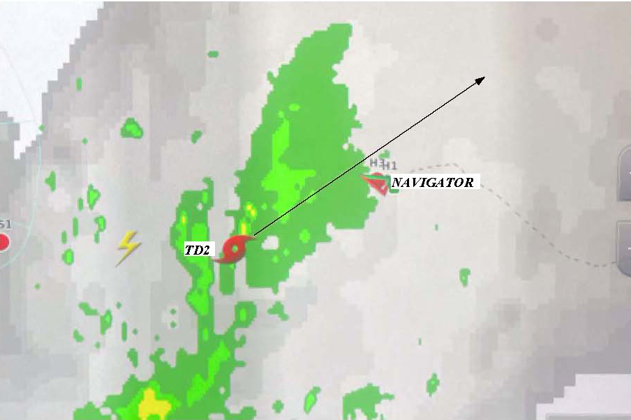
6/14 Monday Tropical Depression 2 provided a teaching moment this afternoon, appearing on the Sirius XM weather graphic about 50 miles to our SW and detailed in the NOAA bulletin as traveling NE at 18 knots to a point 100 miles to our NE thus passing over our position at about 1700 EDT.
We took the opportunity to plot the Position of TD2, it’s
forecast track, wind direction and Barometer trends to predict which side of its track we would
be on as it passed. So we plotted this information on our navigation chart, and
decided to make an avoidance move putting the wind on our starboard quarter and
motoring at high rpm to the safe side to the left of track. I think we were
directly in its path based of this analysis.
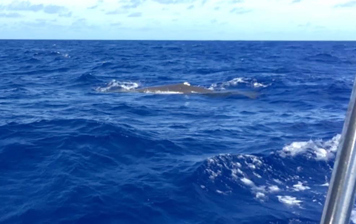
At 2015 we are now sailing pleasantly on a course of 300 degrees per compass in SW winds of 8 to 10 knots with reefed mainsail and full genoa. I'm keeping the mainsail reefed since we are going into nighttime and are surrounded by threatening storm clouds in various locations around the compass. Sea water temperature is increasing indicating that we are entering the Gulf Stream, and we were accompanied by a whale overtaking us on starboard side!
6/15 Monday This afternoon the crew worked as a team preparing the navigation plan for entrance to Chesapeake Bay on paper charts and entered
electronic waypoints into the chart plotter. Up to now, we sighted very few commercial ships during this passage, which is much to my liking since they always pose a danger to a small boat at sea. This afternoon we sighted another ship with a projected closest point of approach across our bow at two miles from right to left based on radar observations, but no AIS signal showing! This was the second ship that we saw with our eyes and radar, but with no AIS signal. Frank did some investigating of our AIS settings, and found that our AIS receive feature was turned off. We speculate that this was from low system voltage coupled with high current draw during an engine startup or from an accidental button push by a crewmember. In any event, Frank restarted the AIS receive function, which is vitally important to our operations to be able to see other traffic. 6/16 Tuesday
We proceeded to Little Creek Harbour arriving there about
2200. Rita had previously communicated with the marina as to our assigned slip
number and directions for finding it in the dark with no dockhand available, and
we made a comfortable docking in the wee hours. Before entering, I called the US Customs after hours phone
number at the Norfolk International Airport to advise them of our arrival and
was told to call back in the morning to another number that they gave me. So we
all went to bed, exhausted and happy for the nap. 6/17 Wednesday
At 0800, I called the US Customs daytime office, and they arranged for
Customs and Immigration and Health officers to visit us at the boat, which they
did by 1000 and cleared all crewmembers back into the US. But, I was also told
that I had to visit the US Customs office in Norfolk to clear the boat in. I
questioned that this was a new procedure not required in previous years, but was
told that this was now the new procedure. So after bidding farewell to our departing
crewmembers, I trundled myself down to downtown Norfolk to the US Customs
office, a foreboding looking stone and marble structure dating back to the 19th
Century. Inside, things were proceeding at a 19th Century pace with one clerk
assisting a man clearing in a commercial ship and negotiating lots of paperwork
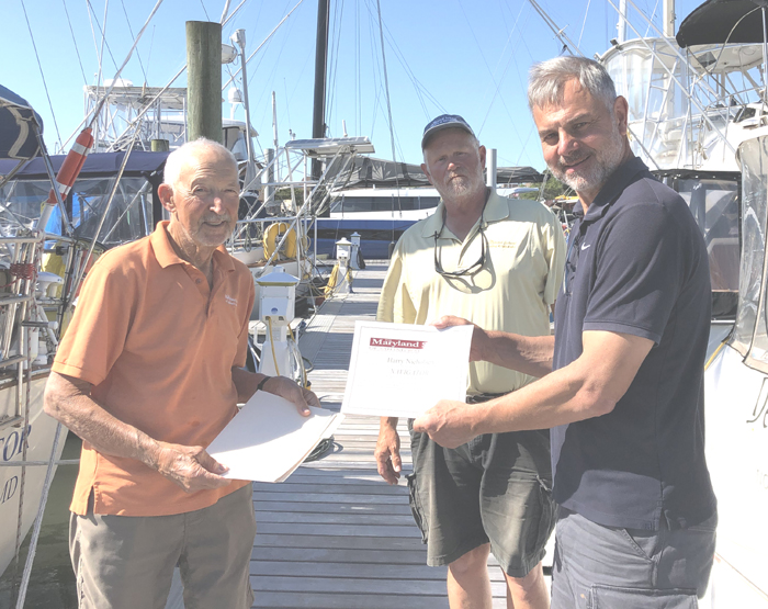
and fees for the various cargo onboard. While I awaited my turn, I struck up a conversation with another gentleman waiting his turn who turned out to be the Master of Pride of Baltimore also just returned from Bermuda. After he cleared in, I addressed the clerk with my ship's papers only to be told: "Oh, that was a mistake; you did not need to come here to clear in." ??? Well, that was done, but when I returned to my car I found a $35 parking ticket for an expired parking meter!! Captain Tom Tursi |

Web site design by F. Hayden Designs, Inc.